Table of Contents
1. Introduction: Harnessing the Power of Aerial Visualization
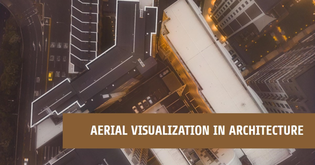
Aerial visualization in architecture has become a transformative tool, offering architects and designers unique perspectives and insights into spatial relationships, site context, and design integration. In this guide, we delve into the intricacies of aerial visualization techniques, its applications across various architectural projects, and essential tips for achieving stunning aerial renderings.
2. Understanding Aerial Visualization
Aerial visualization involves creating visual representations of architectural designs, landscapes, and urban environments from elevated viewpoints, mimicking the perspective of aerial photography or drone captures. This technique provides a bird’s-eye view of projects, allowing architects to showcase design elements, site features, and contextual surroundings comprehensively. Aerial visualization plays a crucial role in site analysis, master planning, and communicating design concepts to clients, stakeholders, and regulatory bodies.
3. Leveraging Drone Technology for Aerial Capture
The advent of drone technology has revolutionized aerial visualization in architecture, enabling architects to capture high-resolution aerial images and videos with precision and flexibility. Drones equipped with advanced cameras and sensors can capture site details, topographical information, and 3D point clouds, enhancing the accuracy and realism of aerial visualizations. Integrating drone captures into architectural workflows streamlines site surveys, progress monitoring, and environmental assessments, empowering architects with real-time data for informed decision-making.
4. Incorporating Aerial Visualization in Design Processes
Architects can integrate aerial visualization at various stages of the design process to gain valuable insights and optimize design outcomes. Early-stage conceptual designs benefit from aerial context studies, where architects analyze site constraints, orientation, sun path analysis, and views to inform design strategies. During schematic design and design development phases, aerial renderings help visualize massing, spatial relationships, and landscape integration, fostering design coherence and functionality.
5. Enhancing Spatial Awareness and Site Context
Aerial visualization offers architects a holistic view of project sites, surrounding contexts, and neighborhood dynamics, facilitating informed design decisions aligned with site-specific conditions. By analyzing aerial imagery, architects can identify natural features, terrain variations, infrastructural networks, and contextual landmarks that influence design interventions. This heightened spatial awareness ensures designs harmonize with their surroundings, respect site heritage, and optimize environmental performance.
6. Communicating Design Concepts Effectively
Visual storytelling is a powerful tool in architecture, and aerial visualization serves as a compelling medium to communicate design concepts, project visions, and design narratives effectively. Aerial renderings and fly-through animations convey project scale, urban context, circulation patterns, and spatial hierarchies in a visually engaging manner. Architects leverage these visuals in client presentations, public consultations, and design competitions to garner support, feedback, and approvals for projects.
7. Integrating GIS Data for Contextual Analysis
Geographic Information Systems (GIS) data integration enriches aerial visualization by overlaying site-specific data layers such as land use, zoning regulations, environmental factors, and demographic profiles. Architects leverage GIS mapping tools to analyze site potentials, assess environmental impacts, and develop design strategies that respond to regional contexts and community needs. This data-driven approach fosters sustainable design practices, resilience planning, and informed decision-making in architectural projects.
8. Optimizing Rendering Techniques for Aerial Views
Achieving stunning aerial visualizations requires optimizing rendering techniques, lighting effects, and material representations to capture realistic aerial perspectives. Architects utilize advanced rendering software such as Lumion, V-Ray, and Enscape to create atmospheric effects, realistic terrains, and vibrant landscapes in aerial renderings. Attention to detail in vegetation, water bodies, shadows, and ambient lighting enhances the visual impact and authenticity of aerial visualizations.
9. Collaborative Aerial Visualization Workflows
Collaboration is key in architectural projects, and collaborative aerial visualization workflows enable multidisciplinary teams to collaborate seamlessly on aerial renderings, GIS data integration, and design analysis. Architects collaborate with drone operators, GIS specialists, urban planners, and environmental consultants to capture, analyze, and visualize site data comprehensively. Cloud-based platforms facilitate data sharing, version control, and real-time collaboration, ensuring project teams stay aligned and informed throughout the design process.
10. Conclusion: Elevating Architectural Vision with Aerial Visualization
In conclusion, aerial visualization emerges as a transformative tool that empowers architects to elevate their architectural visions, contextualize designs within broader landscapes, and communicate design narratives effectively. By harnessing drone technology, GIS data integration, advanced rendering techniques, and collaborative workflows, architects unlock new perspectives, insights, and opportunities for innovation in architectural projects. Aerial visualization not only enhances design processes but also fosters sustainable, context-sensitive, and visually compelling architectural solutions that resonate with clients, communities, and the built environment.