Table of Contents
1. Introduction: The Fusion of Technology and Design
In the realm of architectural visualization, the integration of drones and video technology has ushered in a new era of precision, realism, and creativity. This blog post delves into the innovative use of drones as a basis for 3D modeling in architectural visualization, highlighting its impact, benefits, challenges, and future possibilities.
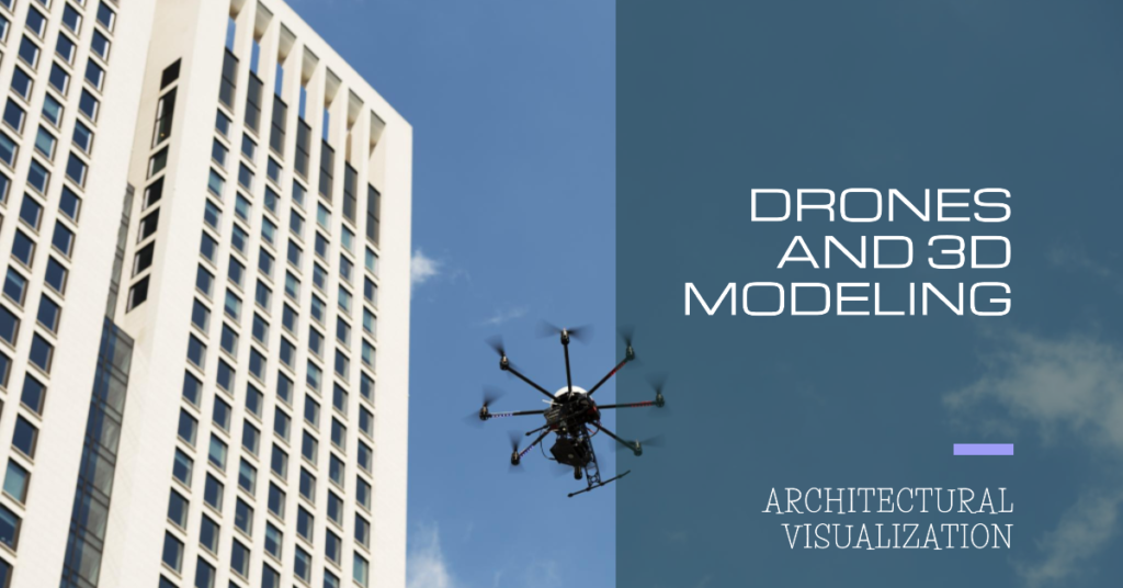
2. Understanding Drones in Architectural Visualization
Drones, also known as Unmanned Aerial Vehicles (UAVs), have become invaluable tools for capturing aerial perspectives of landscapes, buildings, and construction sites. Architects and 3D artists harness drone technology to gather high-resolution videos and images, providing detailed insights into site conditions, topography, building structures, and surrounding environments. These aerial data serve as foundational elements for creating accurate and immersive 3D models, enriching architectural visualization projects with real-world context and spatial accuracy.
3. Leveraging Video Footage for Detailed 3D Modeling
The utilization of drone-captured video footage as a reference for 3D modeling offers unparalleled advantages in capturing intricate details, scale, proportions, and spatial relationships. By analyzing video frames, architects and designers can extract essential data points, such as building dimensions, textures, materials, lighting conditions, and environmental features. This meticulous approach enhances the fidelity of 3D models, ensuring they align seamlessly with real-world structures and landscapes.
4. Enhancing Realism and Context in Architectural Renders
One of the key strengths of incorporating drone-based video data into architectural visualization is the heightened realism and context it provides to rendered images and animations. By integrating accurate aerial perspectives, terrain features, building orientations, and surrounding elements from video footage, 3D renders gain a sense of depth, scale, and environmental integration that significantly enhances their visual impact and storytelling potential. Clients, stakeholders, and viewers can better comprehend design concepts within their real-world contexts, fostering informed decision-making and appreciation for architectural visions.
5. Overcoming Challenges in Drone-Based Modeling
While the use of drones for architectural visualization offers immense benefits, it also comes with technical and regulatory challenges. Ensuring flight safety, complying with airspace regulations, obtaining necessary permits, managing data acquisition and storage, and processing large video datasets require expertise, planning, and adherence to industry standards. Collaboration between drone operators, architects, and 3D artists is essential to streamline workflows, optimize data utilization, and mitigate risks associated with drone operations.
6. Innovations in Drone Technology and Software Integration
Advancements in drone technology, camera capabilities, and software tools have propelled the capabilities of drone-based architectural visualization. High-resolution cameras, LiDAR sensors, thermal imaging, and photogrammetry techniques enable drones to capture detailed data for modeling complex structures and environments. Integration with specialized software such as photogrammetry software, CAD programs, and 3D modeling suites facilitates seamless data processing, analysis, and visualization, empowering designers to create stunningly accurate and immersive virtual representations.
7. Future Prospects and Industry Adoption
The synergy between drones and architectural visualization continues to evolve, with increasing adoption across architectural firms, construction companies, urban planning agencies, real estate developers, and entertainment industries. As drone technology matures, advancements in autonomous flight, data analytics, real-time processing, and augmented reality (AR) integration hold immense potential for streamlining design workflows, conducting site inspections, monitoring construction progress, and engaging stakeholders with interactive visualizations.
8. Environmental and Sustainability Applications
Beyond architectural design, drones play a pivotal role in environmental monitoring, land-use planning, disaster response, and sustainability assessments. By capturing aerial data on vegetation, terrain changes, water bodies, and ecological patterns, drones contribute to informed decision-making in sustainable design practices, habitat preservation, and resource management. Integrating environmental data into architectural visualizations fosters holistic design approaches that harmonize built environments with natural ecosystems.
9. Collaborative Opportunities and Cross-Disciplinary Innovation
The intersection of drone technology and architectural visualization fuels collaborative opportunities among architects, urban planners, landscape designers, environmental scientists, and technology experts. Cross-disciplinary collaborations drive innovation in smart cities development, infrastructure design, heritage preservation, urban resilience, and digital twin initiatives. Shared data platforms, collaborative design tools, and interdisciplinary workshops foster creativity, problem-solving, and sustainable development practices in the built environment.
10. Conclusion: Aerial Perspectives, Artistic Visions


In conclusion, the fusion of drones and architectural visualization represents a transformative synergy bridging aerial perspectives with artistic visions. The precision, realism, and contextual richness derived from drone-captured video data empower architects and designers to craft compelling narratives, communicate design intent effectively, and shape resilient, sustainable built environments. Embracing technological advancements, regulatory frameworks, collaborative practices, and environmental consciousness paves the way for a future where aerial insights and digital creativity converge to redefine the boundaries of architectural innovation.